South Kootenay Green Link Active Transportation Plan
JOIN THE CONVERSATION - SHAPE THE FUTURE OF ACTIVE TRANSPORTATION IN SOUTH KOOTENAY
The South Kootenay Green Link: Connecting Communities, Promoting Healthy Living, and Fostering Environmental Sustainability

Project Background
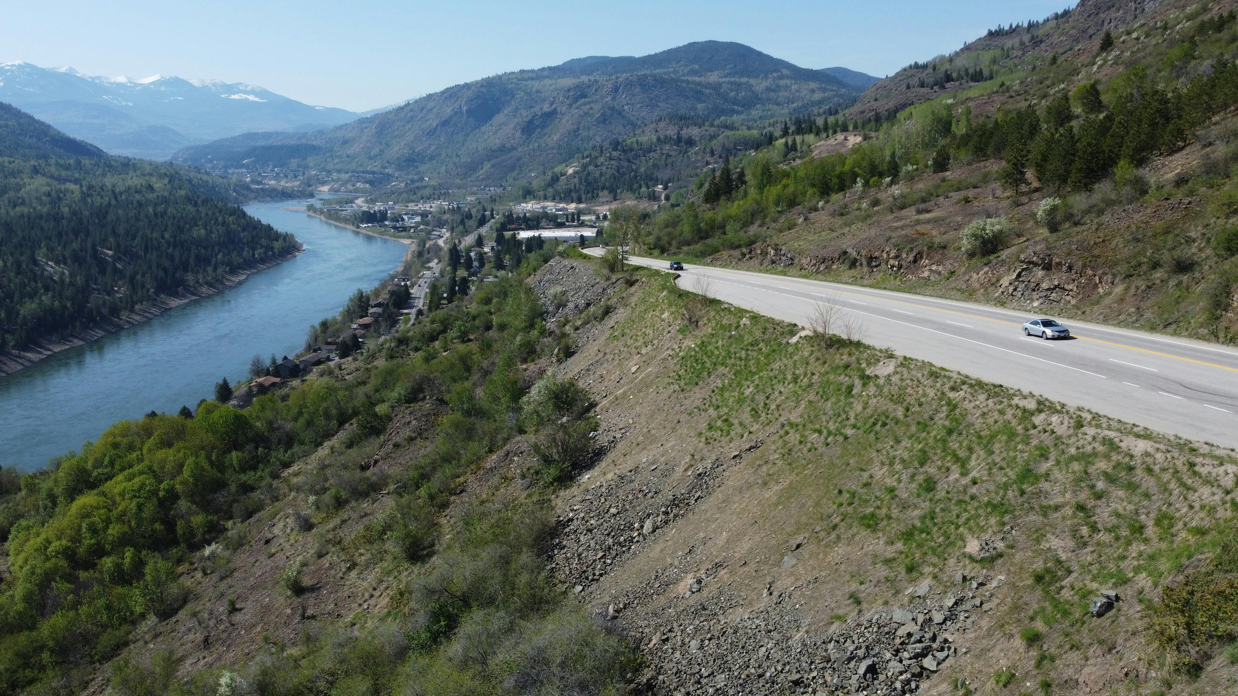
The South Kootenay region, celebrated for cultivating both professional and recreational sports enthusiasts, is setting its sights on a new, ambitious initiative - the South Kootenay Green Link Active Transportation Plan (ATP). With a $50,000 grant from BC's Active Transportation Network Planning program, matched by funds from the Regional District of Kootenay Boundary (RDKB), we are poised to create a comprehensive, accessible, multi-use active transportation connection between Rossland and Fruitvale.
Plan Process

Objective
The South Kootenay Green Link ATP will establish an integrated active transportation corridor that promotes sustainable and healthy modes of travel. The project will address the need for safe, interconnected routes for cyclists, pedestrians, and other active transportation users. It will tackle the region's unique challenges, such as varying elevations and routes adjacent to highways. By focusing on inclusivity and adhering to best practices from the BC Active Transportation Design Guide, the ATP seeks to make active transportation a practical and attractive choice for all residents.
Safety and Challenges
Despite the natural beauty and opportunities for outdoor activities in the region, there is a lack of interconnected, safe, and accessible routes for cyclists, pedestrians and other active transportation users. This hinders the ability of residents to adopt more sustainable modes of transportation, leading to increased car usage, environmental impact, and missed opportunities for health and well-being. The region presents unique challenges for active transportation, including varying elevations and direct routes adjacent to highways. The planning process will explore solutions to these issues.
Solution
The South Kootenay Green Link ATP aims to address these challenges by developing an All Ages and Abilities (AAA) active transportation corridor, guided by the BC Active Transportation Design Guide (2019). This Active Transportation connection will be comfortable, convenient, attractive, and safe for everyone, encouraging more residents to embrace active transportation and leading to a healthier, more environmentally conscious community.
Engagement and Feedback
The South Kootenay Green Link led by the Steering Committee, comprising of representatives from the involved communities and the Ministry of Transportation and Infrastructure, is committed to engaging stakeholders and the public throughout the process. Together, we can create a vibrant, connected, and sustainable active transportation network.
What is Active Transportation?
Active transportation, as defined in the BC Active Transportation Design Guide, includes any form of human-powered transportation, including walking, cycling, or rolling using a skateboard, in-line skates, wheelchair or other wheel-based forms of human-powered transportation.

Who's Listening
-
Phone 250-368-0237 Email ddean@rdkb.com -
Phone 250-215-0544 Email ncarswell@wattconsultinggroup.com
Documents
-
 SKGL ATP Round 2 Survey Information Package - 240604.pdf (6.96 MB) (pdf)
-
SKGL ATP Round 2 Survey_Preferred_Route Segments -240604.pdf (4.32 MB) (pdf)
-
SKGL ATP Round 2 Survey_Facility_Type_Segments -240604.pdf (3.95 MB) (pdf)
-
Steering Committee Report 1 - SKGL Baseline Conditions.pdf (10.9 MB) (pdf)
-
RDKB - SKGL ATP What We Heard Report (9.61 MB) (pdf)
-
Rossland Active Transportation Network Review (2022) (47 MB) (pdf)
-
City of Trail Active Transportation Plan (2023)